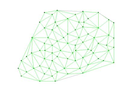
Boundary delineation techniques for point data require that the sample locations be connected using a nearest-neighbor algorithm (see the sample points connected by a network below). BoundarySeer automatically generates a Delaunay network for each point data set before boundaries are detected.
Often spatial networks contain links between points that are actually located outside of the study area, or the links connect points you would not consider adjacent for some other reason. These links are problematic because boundaries might inadvertently be detected in areas that are not meaningful within the context of your study. For instance, in the example below of stream samples, some of the Delaunay triangles may have centroids that are on land. Since the centroid is where the wombling Boundary Likelihood Value is calculated, this location would not make sense as a boundary in the data. You can remove these inappropriate links between points by editing the spatial network.

In addition, the Delaunay network often connects widely spaced locations near the periphery of the data set. In most cases it does not make sense to compare two distant points. BoundarySeer automatically deactivates some of these links (note the gray links in the figure above). Even if you do not think that you have edits to make, you should view and edit the network to verify BoundarySeer's decisions about which links to automatically deactivate.
Next step:
See also: