![]() Choose to select links by intersection with a spatial feature using the spatial network toolbar.
Choose to select links by intersection with a spatial feature using the spatial network toolbar.
Choose to intersect the spatial network with the "outline". Click "Intersect" to proceed. This selects all links that intersect the edges of the islands.
![]() Turn off all selected links.
Turn off all selected links.
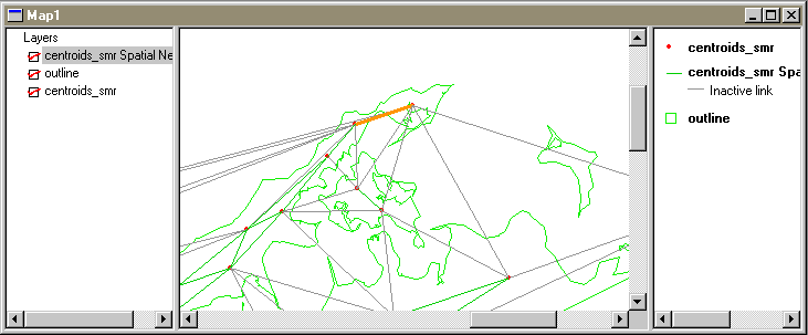
Inspect the network by zooming in and panning around. The active links are in green, the inactive ones in grey. Selected links are orange.
![]() You may wish to reinstate a few links that isolate areas completely (say where there is a land connection between two ZIP codes but not where the link is, such as at the north fork of Long Island, illustrated below).
You may wish to reinstate a few links that isolate areas completely (say where there is a land connection between two ZIP codes but not where the link is, such as at the north fork of Long Island, illustrated below).
