Once you have imported the warbler data, you are ready to import the vegetation data. Each of the nine variables is contained in a separate ARC/INFO grid file; we will import them together as one data set.
Select "Data | Import | Custom | Multiple ARC/INFO Grid" from the main menu.
Import Raster Data: Navigate to the subdirectory "Reeses Vegetation" in the Samples directory, select all nine files by holding down the Shift key, and click "Import".
Import Data Set: BoundarySeer automatically names the data set according to one of the files. Enter an appropriate name for the data set, such as "Vegetation". Choose a planar projection and user coordinates. Click "Next."
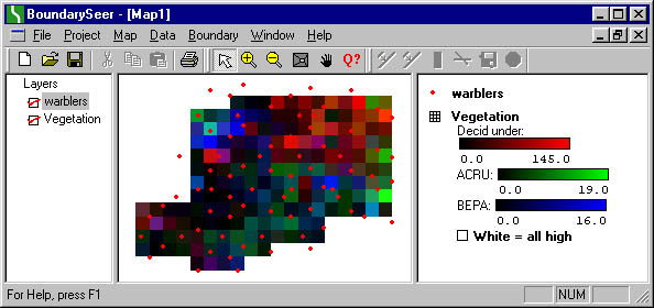
View Data in Map: The dataset has imported. Choose "Yes" to view the data in a map. Note that the raster is overlaid on top of the songbird locations; to rearrange the ordering of map layers, simply click and drag the layer names to the left of the map.
![]()
![]()