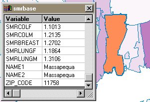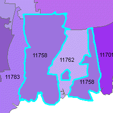
Note: representing three part polygons like ZIP 11758 is different in BoundarySeer than in other GIS programs. For the sake of spatial analysis, BoundarySeer breaks up multi-part polygons into their constituent pieces. So, when SMRbase is in BoundarySeer, there are 3 11758 labelled polygons, and the data is duplicated for each one. While this is OK for rate data, it would not be appropriate for count data, as the counts would be tripled in the case of 11758 (as the same count would be applied to each piece of the ZIP code).